ZoneAI™

ZoneAI™

ZoneAI™

Instant Zoning Intelligence. Any Market.

ZoneAI™ delivers the zoning rules you need, in any city or county, instantly.

Book a Demo
Detailed interactive map showing zoning designations, parcel boundaries, city and county boundaries, with dense road networks and color-coded zones for residential, commercial, and agricultural areas.
Map interface showing a residential zoning area with parcel boundaries and measurements, alongside zoning and property info details.

The Problem

Zoning Research Kills Momentum

Days spent deciphering municipal codes. Acquisition opportunities tied up while you're still researching. Deals lost because you couldn't verify zoning fast enough.

Traditional zoning research doesn't just waste time. It costs deals. While you research, competitors decide.

The Solution

Your Personal Zoning Expert, Instantly

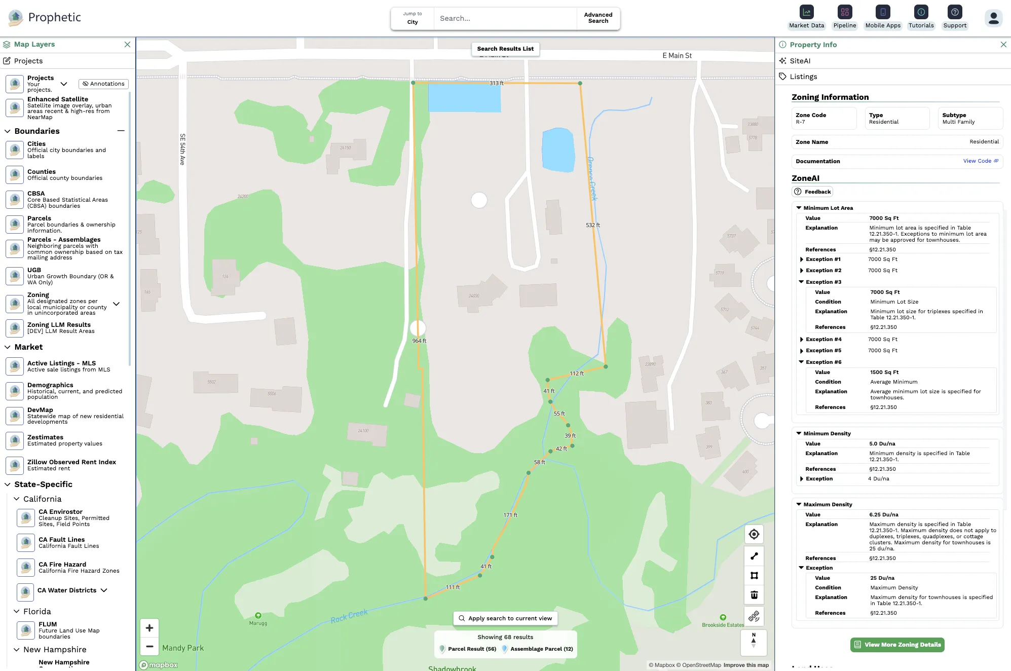
ZoneAI™ reads and interprets municipal codes in seconds. Get clear answers on permitted uses, density, setbacks, and height limits across any jurisdiction nationwide.

Stop researching. Start deciding.

Answer "Can we build there?" during landowner calls. Enter new markets with local-expert confidence. Screen dozens of parcels in the time it used to take to research one.

Customer Impact

From Days to Seconds

Fast time graphic icon.

Days of research → Seconds of clarity

Confidence graphic icon.

Limited to familiar markets → Confident anywhere

AI Knowledge graphic icon.

Uncertainty kills deals → Knowledge closes them

"Prophetic's built-in zoning analysis (ZoneAI™) has completely transformed how we evaluate land. We can assess far more parcels in a fraction of the time. Having this insight during calls with landowners is invaluable."
— VP of Land Acquisition, Mid-Market Developer

What You Get

Everything You Need to Understand Development Potential

Works across all 50 states. Always current. Always accurate.

Map showing a land parcel outlined in orange with dimensions. The right side displays zoning information detailing permitted, conditional, limited, and special land uses including community garden, residential housing, public park, boat dock, and small wind turbines.

What you can build

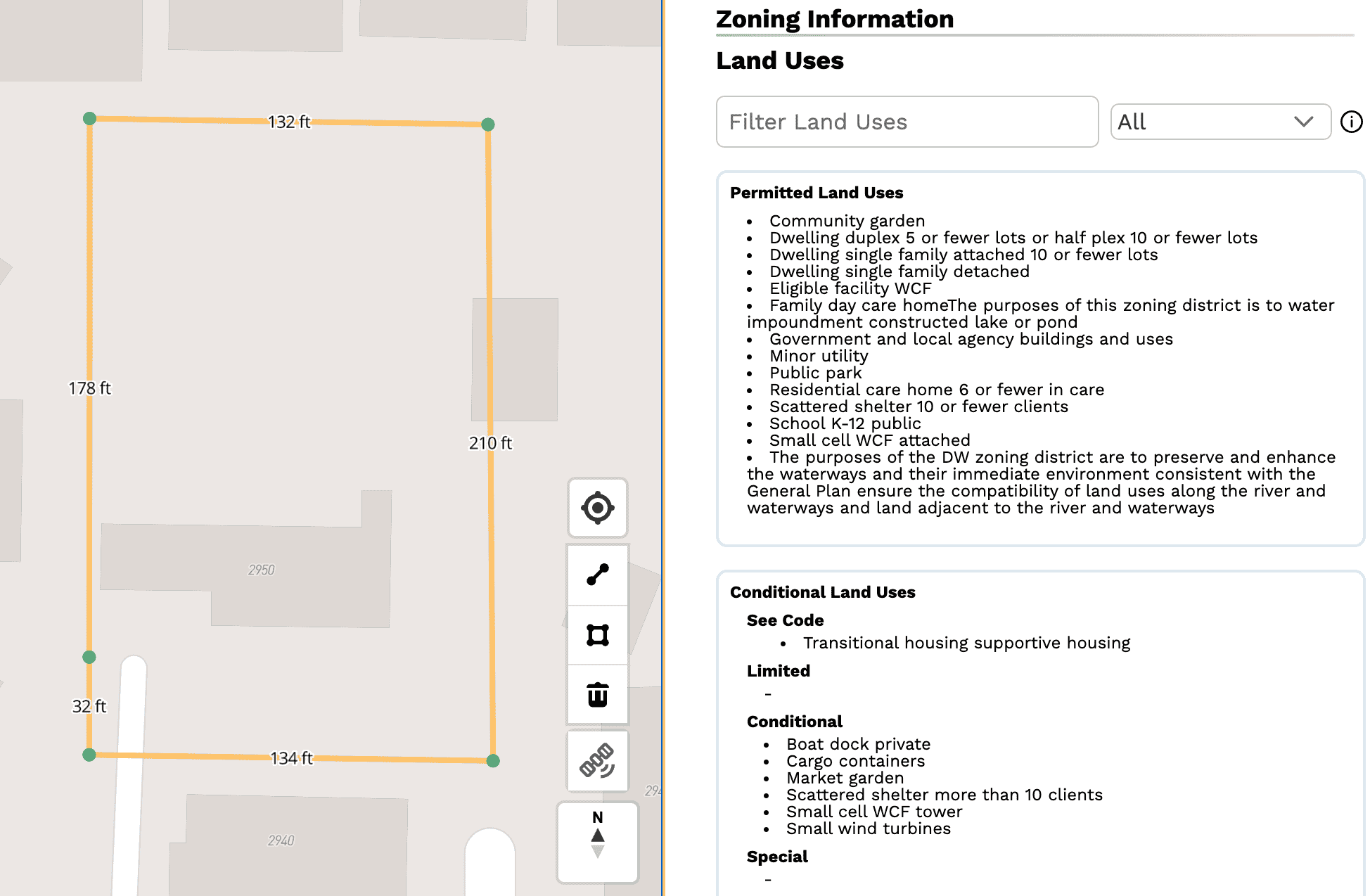
Permitted, conditional, and accessory uses explained clearly, for every
zone, in every municipality

Table showing minimum lot area requirements for various building types under ZoneAI, including 0 square feet for URX, 3500 square feet for single-family dwellings, 2500 square feet per unit for duplexes, and 6000 square feet for triplexes and multi-family dwellings, with references to district standards.

How dense you can go

Minimum lot sizes, min/max density, FAR, and more

Table listing physical requirements including minimum lot depth (80 Ft), lot width to depth ratio (0.25), minimum setback front (25 Ft) with an exception of 2.5 Ft or 10% reduction, minimum setback side (combined 15 Ft, minimum 5 Ft each side), minimum setback rear (25 Ft), no max floor area ratio, no min floor area ratio, and maximum height of 2 stories or 24 Ft wall plate height.

Physical requirements

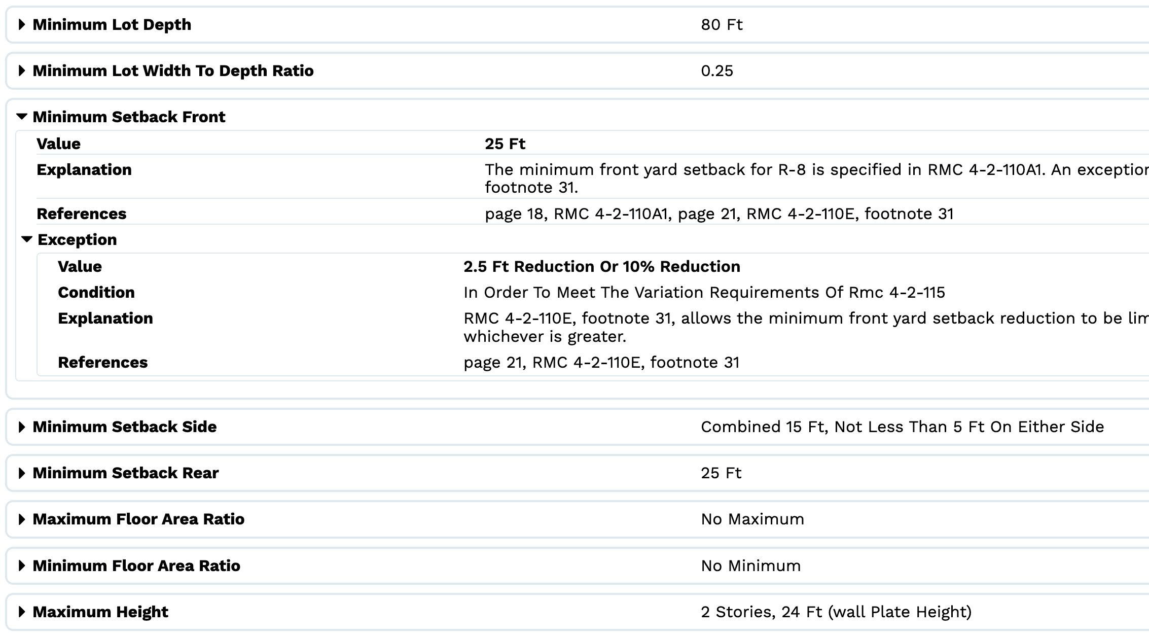
Heights, setbacks, parking requirements, max coverage, and more

Enter Any Market with Confidence

See how ZoneAI™ gives you instant zoning clarity across every jurisdiction, eliminating research delays and enabling confident decisions anywhere.

See ZoneAI in Action