


You pay a certain price per developable lot that a parcel can yield.
The landowner asks:
"How many lots can my land yield?"
You answer:
"I'll get back to you in two to four weeks."
By then, they've talked to three other developers who moved faster. Speed equals credibility. Credibility creates advantage.
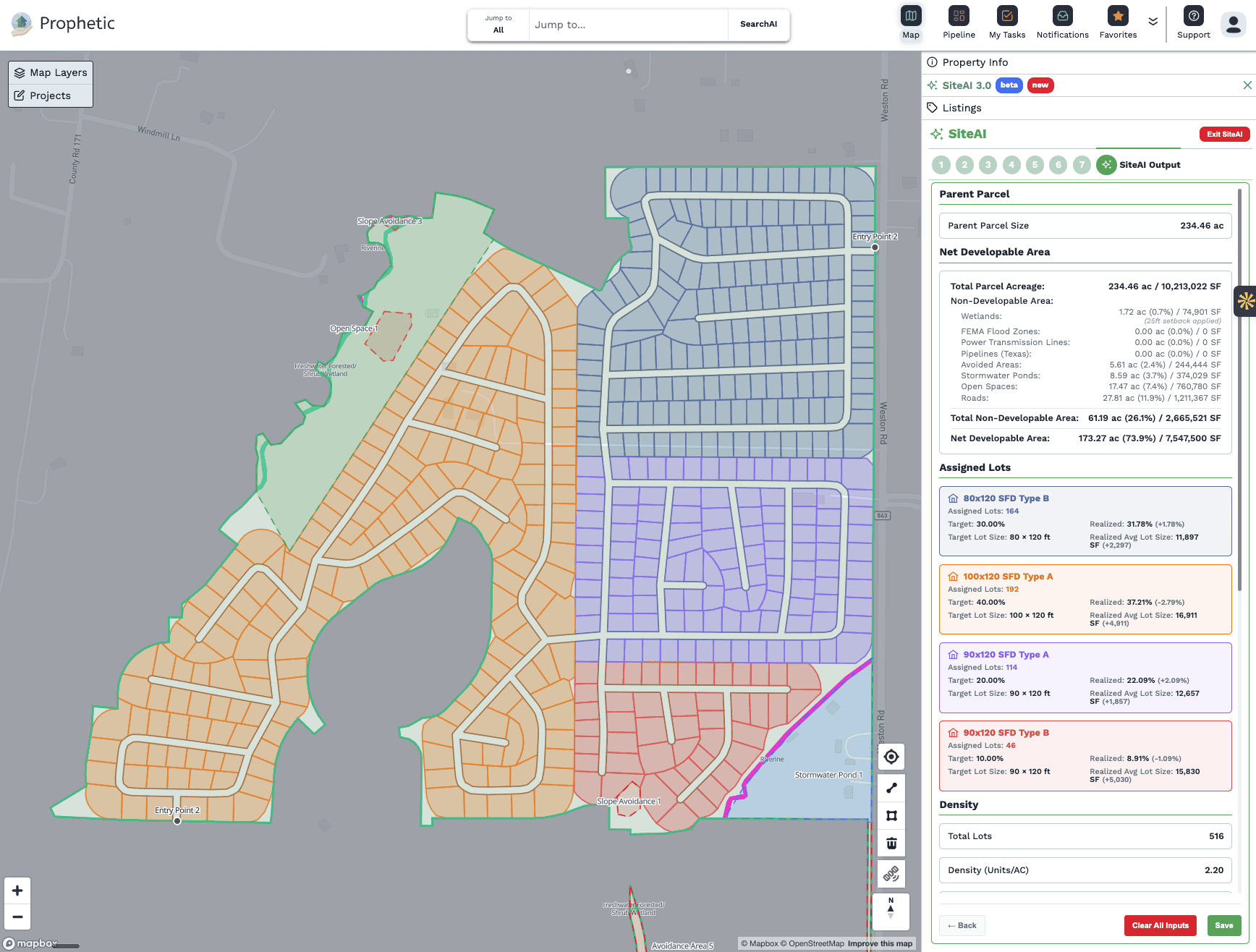
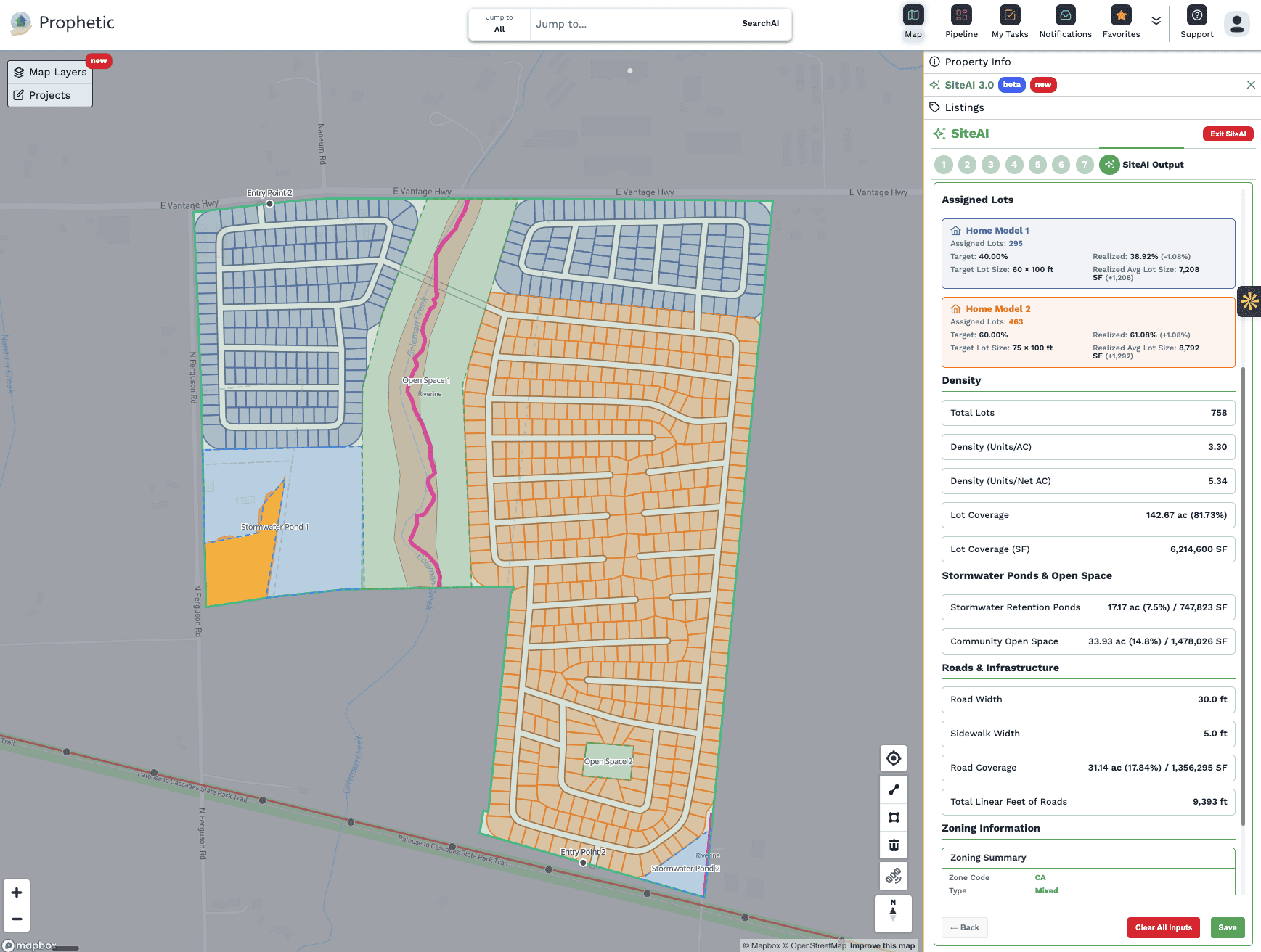
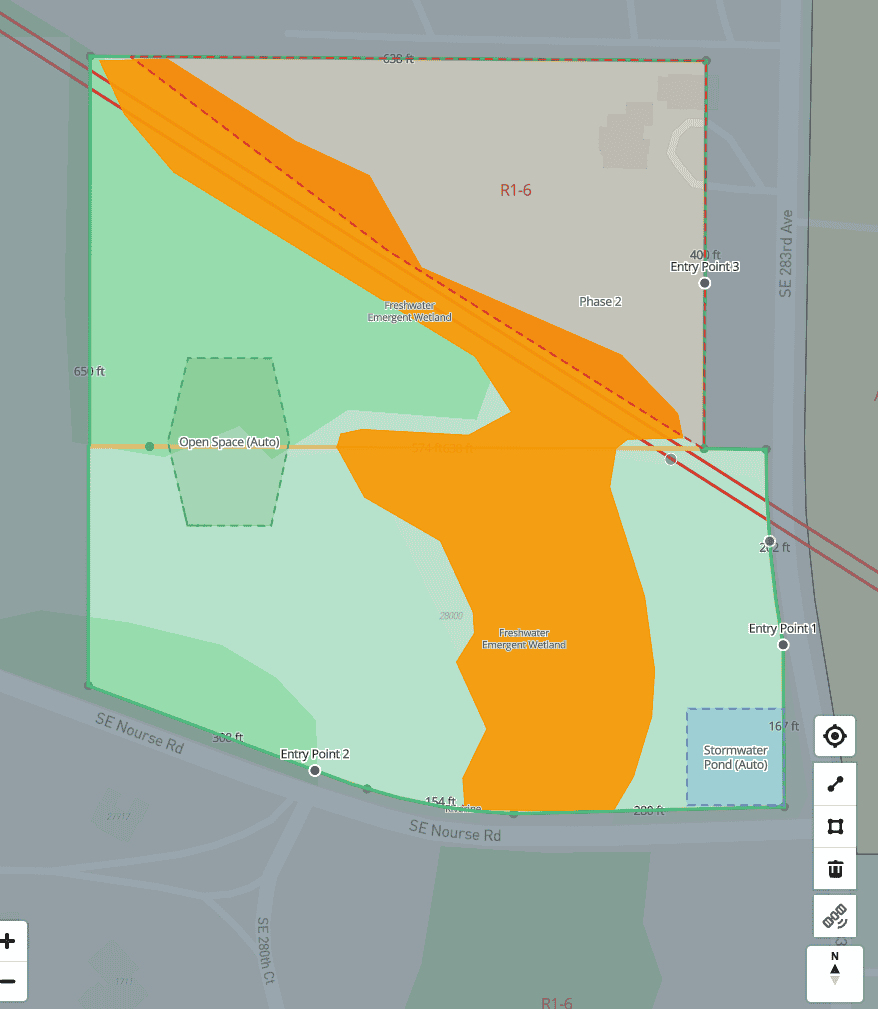
SiteAI™ performs in seconds what traditionally takes days or weeks, and costs thousands. With SiteAI™, create accurate yield estimates that avoid wetlands & flood zones (including customizing to match real-world conditions), topographical awareness, zoning controls, varying home product types, and much more.
Answer development questions during initial conversations.
Screen your entire pipeline in an afternoon. Prepare offers backed by real feasibility data. Demonstrate you're a serious buyer and set yourself apart from off-market landowners.


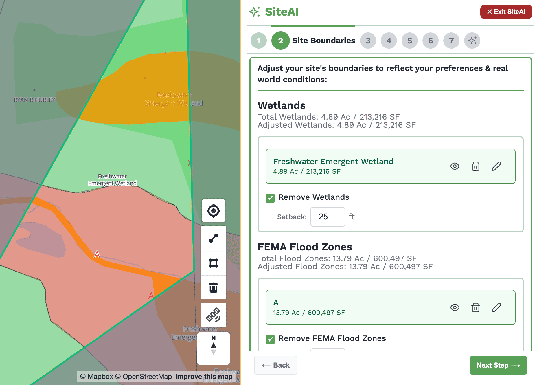
Setbacks, wetlands, floodplains, slopes, easements mapped and explained with sources cited
Maximum units based on actual buildable area with calculations you can verify
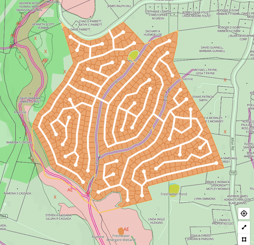
Interactive site plans showing how units could be configured with real-time scenario testing

